Make a donation
Gear up for your next adventure:
As an Amazon Associate, this site earns from qualifying purchases at no extra cost to you.
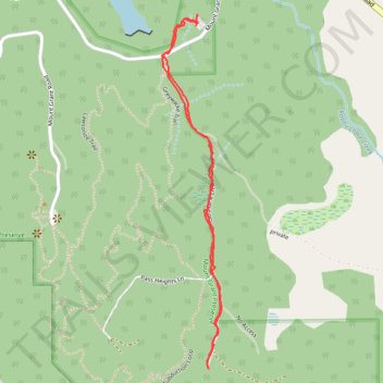
Geraldine Lane in Mount Grant Preserve
- Distance: 1.3 mi
- Elevation gain: 95 ft
- Maximum elevation: 404 ft
- Elevation loss: 92 ft
- Minimum elevation: 354 ft
- Moving time: 39 m 51 s
- Moving speed: 1.9 mph
- Maximum speed: 4.5 mph
- Total time: 46 m 22 s
- Global speed: 1.6 mph
Interactive trail map
Make a donation
Gear up for your next adventure:
As an Amazon Associate, this site earns from qualifying purchases at no extra cost to you.
Trail profile
- Distance: 1.3 mi
- Elevation gain: 95 ft
- Maximum elevation: 404 ft
- Elevation loss: 92 ft
- Minimum elevation: 354 ft
- Moving time: 39 m 51 s
- Moving speed: 1.9 mph
- Maximum speed: 4.5 mph
- Total time: 46 m 22 s
- Global speed: 1.6 mph
Make a donation
Gear up for your next adventure:
As an Amazon Associate, this site earns from qualifying purchases at no extra cost to you.
About this trail
Name: Geraldine Lane in Mount Grant Preserve trail, distance, elevation, map, profile, GPS track
Start: Mount Grant Road, San Juan County, Washington, United States (48.54477 -123.12164)
End: Mount Grant Road, San Juan County, Washington, United States (48.54452 -123.12168)
Coordinates: 48.53709 -123.12281 48.54477 -123.12085
Topography: San Juan County topographic map, elevation, terrain
Make a donation
Gear up for your next adventure:
As an Amazon Associate, this site earns from qualifying purchases at no extra cost to you.
Other hiking, mountain biking, running and outdoor activity trails
Click on a trail to view its statistics, map and profile.
Greywacke Trail, Subduction Loop and Geraldine Lane loop walk in Mount Grant Preserve
United States > Washington > San Juan County
Distance: 1.2 mi • Elevation gain: 167 ft • Maximum elevation: 489 ft