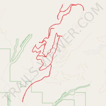
McCormick Peak area
- Distance: 27.3 mi
- Elevation gain: 4,429 ft
- Maximum elevation: 6,227 ft
- Elevation loss: 4,413 ft
- Minimum elevation: 3,333 ft
- Moving time: 3 h 41 m
- Moving speed: 7.4 mph
- Maximum speed: 33.6 mph
- Total time: 4 h 11 m
- Global speed: 6.5 mph
Interactive trail map
Trail profile
- Distance: 27.3 mi
- Elevation gain: 4,429 ft
- Maximum elevation: 6,227 ft
- Elevation loss: 4,413 ft
- Minimum elevation: 3,333 ft
- Moving time: 3 h 41 m
- Moving speed: 7.4 mph
- Maximum speed: 33.6 mph
- Total time: 4 h 11 m
- Global speed: 6.5 mph
About this trail
Name: McCormick Peak area trail, distance, elevation, map, profile, GPS track
Start: 27435, McCormick Creek Road, Missoula County, Montana, 59846, United States (47.13651 -114.51227)
End: 27886, McCormick Creek Road, Missoula County, Montana, 59846, United States (47.13808 -114.51118)
Coordinates: 47.13316 -114.51324 47.19882 -114.45293
Topography: Missoula County topographic map, elevation, terrain
Other hiking, mountain biking, running and outdoor activity trails
Click on a trail to view its statistics, map and profile.
McCormick Peak
United States > Montana > Missoula County
Distance: 2.8 mi • Elevation gain: 906 ft • Maximum elevation: 7,408 ft