Birchden Wood
- Distance: 4.1 mi
- Elevation gain: 331 ft
- Maximum elevation: 249 ft
- Elevation loss: 338 ft
- Minimum elevation: 148 ft
- Moving time: 1 h 28 m
- Moving speed: 2.8 mph
- Maximum speed: 6.8 mph
- Total time: 1 h 48 m
- Global speed: 2.3 mph
Interactive trail map
Trail profile
- Distance: 4.1 mi
- Elevation gain: 331 ft
- Maximum elevation: 249 ft
- Elevation loss: 338 ft
- Minimum elevation: 148 ft
- Moving time: 1 h 28 m
- Moving speed: 2.8 mph
- Maximum speed: 6.8 mph
- Total time: 1 h 48 m
- Global speed: 2.3 mph
About this trail
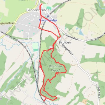
Name: Birchden Wood trail, distance, elevation, map, profile, GPS track
Coordinates: 51.09614 0.18528 51.11468 0.19363