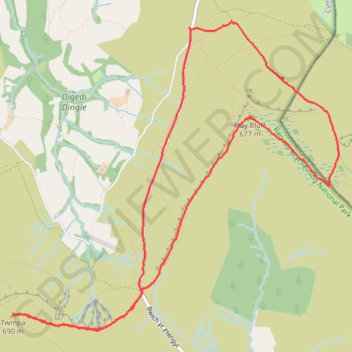
Twmpa and Hay Bluff Loop
- Distance: 5.9 mi
- Elevation gain: 1,142 ft
- Maximum elevation: 2,247 ft
- Elevation loss: 1,142 ft
- Minimum elevation: 1,535 ft
- Moving time: 2 h 33 m
- Moving speed: 2.3 mph
- Maximum speed: 3.4 mph
- Total time: 3 h 45 m
- Global speed: 1.6 mph
Interactive trail map
Trail profile
- Distance: 5.9 mi
- Elevation gain: 1,142 ft
- Maximum elevation: 2,247 ft
- Elevation loss: 1,142 ft
- Minimum elevation: 1,535 ft
- Moving time: 2 h 33 m
- Moving speed: 2.3 mph
- Maximum speed: 3.4 mph
- Total time: 3 h 45 m
- Global speed: 1.6 mph
About this trail
Name: Twmpa and Hay Bluff Loop trail, distance, elevation, map, profile, GPS track
Start: Bwlch yr Efengyl, Llanigon, Powys, Wales, HR3 5RJ, United Kingdom (52.02938 -3.10994)
End: Llanigon, Powys, Wales, HR3 5RJ, United Kingdom (52.02926 -3.10967)
Coordinates: 52.00734 -3.13075 52.02981 -3.09221
Other hiking, mountain biking, running and outdoor activity trails
Click on a trail to view its statistics, map and profile.
The Headstock 500
United Kingdom > Wales > Newport > Newport
Distance: 300.4 mi • Elevation gain: 31,549 ft • Maximum elevation: 2,267 ft