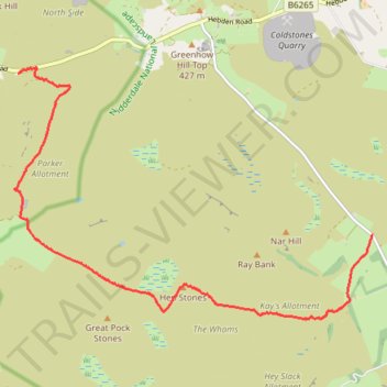
Stump Cross Caverns to Thruscross hike
- Distance: 5.5 mi
- Elevation gain: 696 ft
- Maximum elevation: 1,411 ft
- Elevation loss: 804 ft
- Minimum elevation: 840 ft
- Moving time: 2 h 12 m
- Moving speed: 2.5 mph
- Maximum speed: 4.2 mph
- Total time: 2 h 35 m
- Global speed: 2.1 mph
Interactive trail map
Trail profile
- Distance: 5.5 mi
- Elevation gain: 696 ft
- Maximum elevation: 1,411 ft
- Elevation loss: 804 ft
- Minimum elevation: 840 ft
- Moving time: 2 h 12 m
- Moving speed: 2.5 mph
- Maximum speed: 4.2 mph
- Total time: 2 h 35 m
- Global speed: 2.1 mph
About this trail
Name: Stump Cross Caverns to Thruscross hike trail, distance, elevation, map, profile, GPS track
Coordinates: 54.03932 -1.86594 54.06817 -1.79603