Devil's Playground via Crags to Devils Playground Trail in Pike National Forest
The hike from Crags to Devil's Playground offers a rugged yet awe-inspiring experience in Pike National Forest, providing a blend of forest trails, alpine meadows, and sweeping mountain views. As the trail climbs gradually, hikers encounter beautiful vistas of the Rampart Range and Pikes Peak, with striking rock formations near the summit known as Devil’s Playground, a location famous for its dangerous lightning storms. While the final stretch involves a rocky ascent, the panoramic views, the expansive terrain above the treeline, and the solitude of the route make it a memorable challenge for outdoor enthusiasts. #Hiking #Mountain #Rock #Forest #Nature
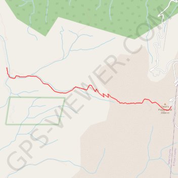
- Distance: 8.0 mi
- Elevation gain: 2,953 ft
- Maximum elevation: 12,930 ft
- Elevation loss: 2,953 ft
- Minimum elevation: 10,010 ft
Interactive trail map
Trail profile
About this trail
Name: Devil's Playground via Crags to Devils Playground Trail in Pike National Forest trail, distance, elevation, map, profile, GPS track
Start: FS 383, Teller County, Colorado, United States (38.87373 -105.12393)
End: FS 383, Teller County, Colorado, United States (38.87373 -105.12393)
Coordinates: 38.86253 -105.12396 38.87373 -105.06869
Topography: Teller County topographic map, elevation, terrain