The Golden Cathedral via Golden Cathedral Trail in Glen Canyon National Recreation Area
The Golden Cathedral Trail in Glen Canyon National Recreation Area offers a unique adventure with sweeping views of Neon Canyon’s surreal landscape. The route takes you through sections of deep sand and slick rock, often requiring off-trail navigation and careful route-finding. Along the way, you’ll cross the Escalante River multiple times, and in the final stretch, the Golden Cathedral’s striking sandstone arches and the soft glow of reflected light from above provide an unforgettable sight. #Hiking #Desert #Canyon #Nature #Sand #Rock #Arch
- Distance: 4.7 mi
- Elevation gain: 469 ft
- Maximum elevation: 5,636 ft
- Elevation loss: 1,345 ft
- Minimum elevation: 4,557 ft
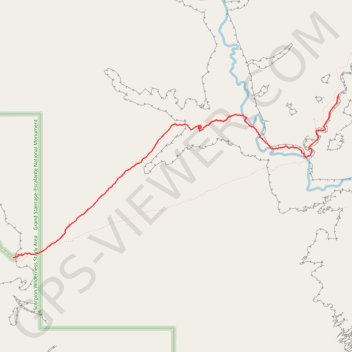
Interactive trail map
Trail profile
- Distance: 4.7 mi
- Elevation gain: 469 ft
- Maximum elevation: 5,636 ft
- Elevation loss: 1,345 ft
- Minimum elevation: 4,557 ft
About this trail
Name: The Golden Cathedral via Golden Cathedral Trail in Glen Canyon National Recreation Area trail, distance, elevation, map, profile, GPS track
End: Golden Cathedral Trail, Garfield County, Utah, United States (37.61524 -111.16273)
Coordinates: 37.59317 -111.21833 37.61524 -111.16273
Topography: Garfield County topographic map, elevation, terrain
Other hiking, mountain biking, running and outdoor activity trails
Click on a trail to view its statistics, map and profile.