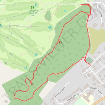
Loop hike in the forest above Strathpeffer
- Distance: 1.5 mi
- Elevation gain: 407 ft
- Maximum elevation: 584 ft
- Elevation loss: 358 ft
- Minimum elevation: 302 ft
- Moving time: 40 m 30 s
- Moving speed: 2.2 mph
- Maximum speed: 5.9 mph
- Total time: 52 m 48 s
- Global speed: 1.7 mph
Interactive trail map
Trail profile
- Distance: 1.5 mi
- Elevation gain: 407 ft
- Maximum elevation: 584 ft
- Elevation loss: 358 ft
- Minimum elevation: 302 ft
- Moving time: 40 m 30 s
- Moving speed: 2.2 mph
- Maximum speed: 5.9 mph
- Total time: 52 m 48 s
- Global speed: 1.7 mph
About this trail
Name: Loop hike in the forest above Strathpeffer trail, distance, elevation, map, profile, GPS track
Start: Strathpeffer, Highland, Scotland, IV14 9BB, United Kingdom (57.58759 -4.54361)
Coordinates: 57.58545 -4.55226 57.59132 -4.54356