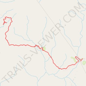
Fiery Gizzard Trail between Foster Falls Campground and Little Cove Campground
- Distance: 5.9 mi
- Elevation gain: 748 ft
- Maximum elevation: 1,857 ft
- Elevation loss: 794 ft
- Minimum elevation: 1,670 ft
- Moving time: 2 h 24 m
- Moving speed: 2.5 mph
- Maximum speed: 4.0 mph
- Total time: 3 h 27 m
- Global speed: 1.7 mph
Interactive trail map
Trail profile
- Distance: 5.9 mi
- Elevation gain: 748 ft
- Maximum elevation: 1,857 ft
- Elevation loss: 794 ft
- Minimum elevation: 1,670 ft
- Moving time: 2 h 24 m
- Moving speed: 2.5 mph
- Maximum speed: 4.0 mph
- Total time: 3 h 27 m
- Global speed: 1.7 mph
About this trail
Name: Fiery Gizzard Trail between Foster Falls Campground and Little Cove Campground trail, distance, elevation, map, profile, GPS track
End: Fiery Gizzard Trail, Marion County, East Tennessee, Tennessee, United States (35.19916 -85.71943)
Coordinates: 35.17739 -85.71997 35.20228 -85.67375
Topography: Marion County topographic map, elevation, terrain
Other hiking, mountain biking, running and outdoor activity trails
Click on a trail to view its statistics, map and profile.
Gmaps Pedometer Route
United States > Kentucky > Fulton County > Hickman
Distance: 312.5 mi • Elevation gain: 13,793 ft • Maximum elevation: 1,942 ft