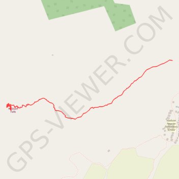
Import a GPX file

Haduan Falls

#Hiking #Nature #Falls #River #Forest

  • Distance: 0.8 mi
  • Elevation gain: 266 ft
  • Maximum elevation: 978 ft
  • Elevation loss: 98 ft
  • Minimum elevation: 774 ft
  • Moving time: 32 m 12 s
  • Moving speed: 1.4 mph
  • Maximum speed: 3.4 mph
  • Total time: 42 m 42 s
  • Global speed: 1.1 mph

Interactive trail map

Trail profile

  • Distance: 0.8 mi
  • Elevation gain: 266 ft
  • Maximum elevation: 978 ft
  • Elevation loss: 98 ft
  • Minimum elevation: 774 ft
  • Moving time: 32 m 12 s
  • Moving speed: 1.4 mph
  • Maximum speed: 3.4 mph
  • Total time: 42 m 42 s
  • Global speed: 1.1 mph

About this trail

Gear up for your next adventure:

🥤Water Filter Bottle - All‑in‑one filter bottle for safe hydration
🧭GPS Watch Accessories - Bands and chargers for GPS watches
📷Action Cameras - Rugged cameras to document your journeys across rugged terrain
🪶Multi‑Purpose Knife - Useful blade for camp and trail
🪶Thermal Camp Blanket - Extra warmth for cold nights

As an Amazon Associate, this site earns from qualifying purchases at no extra cost to you.