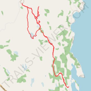
Mt Bike Ride - Lake Laberge
- Distance: 10.2 mi
- Elevation gain: 715 ft
- Maximum elevation: 2,352 ft
- Elevation loss: 715 ft
- Minimum elevation: 2,083 ft
- Moving time: 1 h 55 m
- Moving speed: 5.3 mph
- Maximum speed: 11.5 mph
- Total time: 2 h 12 s
- Global speed: 5.1 mph
Interactive trail map
Trail profile
- Distance: 10.2 mi
- Elevation gain: 715 ft
- Maximum elevation: 2,352 ft
- Elevation loss: 715 ft
- Minimum elevation: 2,083 ft
- Moving time: 1 h 55 m
- Moving speed: 5.3 mph
- Maximum speed: 11.5 mph
- Total time: 2 h 12 s
- Global speed: 5.1 mph
About this trail
Name: Mt Bike Ride - Lake Laberge trail, distance, elevation, map, profile, GPS track
Start: 102, Fossil Point Road, Yukon, Canada (61.08842 -135.20855)
End: 102, Fossil Point Road, Yukon, Canada (61.08846 -135.20855)
Coordinates: 61.08807 -135.24929 61.12345 -135.20855
Other hiking, mountain biking, running and outdoor activity trails
Click on a trail to view its statistics, map and profile.
Laberge Mt Bike Ride
Distance: 11.6 mi • Elevation gain: 1,027 ft • Maximum elevation: 2,415 ft
Laberge Trail Walk
Distance: 4.5 mi • Elevation gain: 259 ft • Maximum elevation: 2,201 ft
Dog Leg on Outer Grazing Fence Trail
Distance: 0.5 mi • Elevation gain: 141 ft • Maximum elevation: 2,231 ft