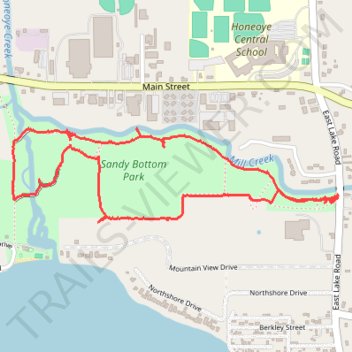
Sandy Bottom Park Nature Loop Trail
- Distance: 2.5 mi
- Elevation gain: 82 ft
- Maximum elevation: 860 ft
- Elevation loss: 82 ft
- Minimum elevation: 804 ft
- Moving time: 1 h 15 m
- Moving speed: 2.0 mph
- Maximum speed: 3.1 mph
- Total time: 2 h 49 m
- Global speed: 0.9 mph
Interactive trail map
Trail profile
- Distance: 2.5 mi
- Elevation gain: 82 ft
- Maximum elevation: 860 ft
- Elevation loss: 82 ft
- Minimum elevation: 804 ft
- Moving time: 1 h 15 m
- Moving speed: 2.0 mph
- Maximum speed: 3.1 mph
- Total time: 2 h 49 m
- Global speed: 0.9 mph
About this trail
Name: Sandy Bottom Park Nature Loop Trail trail, distance, elevation, map, profile, GPS track
Coordinates: 42.78473 -77.51477 42.78807 -77.49899
Topography: Ontario County topographic map, elevation, terrain