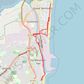
Gorleston and Great Yarmouth Walk
Hike between Gorleston-on-Sea and Great Yarmouth along the River Yare and the North Sea. #Hiking #Sea #River
- Distance: 8.4 mi
- Elevation gain: 167 ft
- Maximum elevation: 52 ft
- Elevation loss: 167 ft
- Minimum elevation: -10 ft
- Moving time: 3 h 14 m
- Moving speed: 2.6 mph
- Maximum speed: 6.4 mph
- Total time: 4 h 52 s
- Global speed: 2.1 mph
Interactive trail map
Trail profile
- Distance: 8.4 mi
- Elevation gain: 167 ft
- Maximum elevation: 52 ft
- Elevation loss: 167 ft
- Minimum elevation: -10 ft
- Moving time: 3 h 14 m
- Moving speed: 2.6 mph
- Maximum speed: 6.4 mph
- Total time: 4 h 52 s
- Global speed: 2.1 mph
About this trail
Name: Gorleston and Great Yarmouth Walk trail, distance, elevation, map, profile, GPS track
Coordinates: 52.56730 1.72265 52.60991 1.73867