Import a GPX file

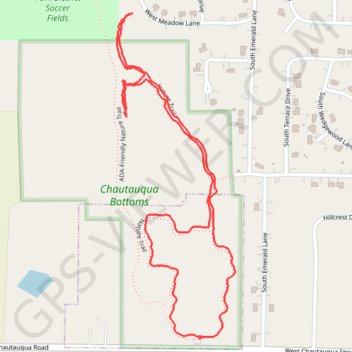
Chautauqua Bottoms Loop (Carbondale)

Loop hike in Chautauqua Bottoms via Nature Trail. #Hiking #Loop #Nature #Forest

  • Distance: 1.8 mi
  • Elevation gain: 52 ft
  • Maximum elevation: 417 ft
  • Elevation loss: 52 ft
  • Minimum elevation: 387 ft
  • Moving time: 41 m 54 s
  • Moving speed: 2.5 mph
  • Maximum speed: 6.5 mph
  • Total time: 43 m 29 s
  • Global speed: 2.4 mph

Interactive trail map

Trail profile

  • Distance: 1.8 mi
  • Elevation gain: 52 ft
  • Maximum elevation: 417 ft
  • Elevation loss: 52 ft
  • Minimum elevation: 387 ft
  • Moving time: 41 m 54 s
  • Moving speed: 2.5 mph
  • Maximum speed: 6.5 mph
  • Total time: 43 m 29 s
  • Global speed: 2.4 mph

About this trail

Gear up for your next adventure:

🧺Microfiber Travel Towels - Compact and fast-drying towels for trail use
🪑Ultralight Camp Chairs - Portable seating for resting after a long day of mapping
📱Heavy-Duty Phone Cases - Drop-proof and waterproof protection for outdoor navigation
🕶️Glacier Sunglasses - Side shields to protect eyes from high-altitude snow glare
🧭Hiking Compass - Precision compass for reliable navigation in the wilderness

As an Amazon Associate, this site earns from qualifying purchases at no extra cost to you.