Hawley Woods Meander
- Distance: 4.2 mi
- Elevation gain: 184 ft
- Maximum elevation: 348 ft
- Elevation loss: 184 ft
- Minimum elevation: 230 ft
- Moving time: 33 m 14 s
- Moving speed: 7.5 mph
- Maximum speed: 16.8 mph
- Total time: 40 m
- Global speed: 6.3 mph
Interactive trail map
Trail profile
- Distance: 4.2 mi
- Elevation gain: 184 ft
- Maximum elevation: 348 ft
- Elevation loss: 184 ft
- Minimum elevation: 230 ft
- Moving time: 33 m 14 s
- Moving speed: 7.5 mph
- Maximum speed: 16.8 mph
- Total time: 40 m
- Global speed: 6.3 mph
About this trail
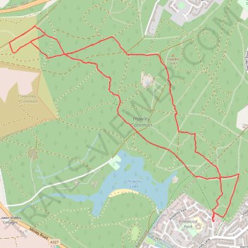
Name: Hawley Woods Meander trail, distance, elevation, map, profile, GPS track
Coordinates: 51.30883 -0.80959 51.32350 -0.78207
Other hiking, mountain biking, running and outdoor activity trails
Click on a trail to view its statistics, map and profile.
Minley Manor missing paths and tracks
United Kingdom > England > Hampshire > Rushmoor > Farnborough
Afternoon Ride
Distance: 3.6 mi • Elevation gain: 207 ft • Maximum elevation: 338 ft