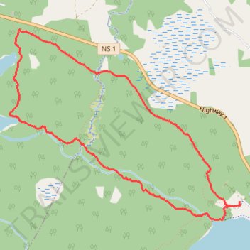
Mount Uniack Estate - Wilderness Loop
- Distance: 4.5 mi
- Elevation gain: 292 ft
- Maximum elevation: 627 ft
- Elevation loss: 292 ft
- Minimum elevation: 512 ft
- Moving time: 1 h 45 m
- Moving speed: 2.5 mph
- Maximum speed: 4.0 mph
- Total time: 1 h 59 m
- Global speed: 2.2 mph
Interactive trail map
Trail profile
- Distance: 4.5 mi
- Elevation gain: 292 ft
- Maximum elevation: 627 ft
- Elevation loss: 292 ft
- Minimum elevation: 512 ft
- Moving time: 1 h 45 m
- Moving speed: 2.5 mph
- Maximum speed: 4.0 mph
- Total time: 1 h 59 m
- Global speed: 2.2 mph
About this trail
Name: Mount Uniack Estate - Wilderness Loop trail, distance, elevation, map, profile, GPS track
Coordinates: 44.90041 -63.87346 44.91746 -63.84429
Other hiking, mountain biking, running and outdoor activity trails
Click on a trail to view its statistics, map and profile.
Red Spruce Trail
Canada > Nova Scotia > Hants County > Mount Uniacke
Distance: 1.7 mi • Elevation gain: 164 ft • Maximum elevation: 633 ft