
Acadia trails to Sargent Mountain
- Distance: 7.2 mi
- Elevation gain: 1,614 ft
- Maximum elevation: 1,345 ft
- Elevation loss: 1,614 ft
- Minimum elevation: 236 ft
- Moving time: 3 h 5 m
- Moving speed: 2.3 mph
- Maximum speed: 8.1 mph
- Total time: 4 h 8 m
- Global speed: 1.7 mph
Interactive trail map
Trail profile
- Distance: 7.2 mi
- Elevation gain: 1,614 ft
- Maximum elevation: 1,345 ft
- Elevation loss: 1,614 ft
- Minimum elevation: 236 ft
- Moving time: 3 h 5 m
- Moving speed: 2.3 mph
- Maximum speed: 8.1 mph
- Total time: 4 h 8 m
- Global speed: 1.7 mph
About this trail
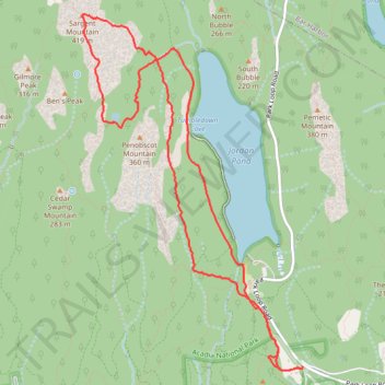
Name: Acadia trails to Sargent Mountain trail, distance, elevation, map, profile, GPS track
Start: Carriage Road, Mount Desert, Hancock County, Maine, 04675, United States (44.31309 -68.24746)
End: 11, Stanley Brook Road, Bar Harbor, Hancock County, Maine, 04609, United States (44.31324 -68.24728)
Coordinates: 44.31286 -68.27346 44.34327 -68.24717
Topography: Hancock County topographic map, elevation, terrain
Other hiking, mountain biking, running and outdoor activity trails
Click on a trail to view its statistics, map and profile.
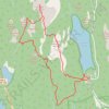
Acadia National Park Trails
United States > Maine > Hancock County > Mount Desert
Loop hike via Spring Trail, Penobscot Mountain Trail, Sargent Mountain South Ridge Trail, Maple Spring Trail, Hadlock Brook Trail, Amphitheatre Trail, Around-Mountain Carriage Road and Asticou & Jordan Pond Path.
Distance: 7.9 mi • Elevation gain: 1,739 ft • Maximum elevation: 1,345 ft
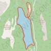
Jordan Pond Loop and South Bubble in Acadia National Park
United States > Maine > Hancock County > Mount Desert
The Jordan Pond Loop and South Bubble hike offers a scenic blend of serene lakeside walking and more adventurous climbs. The loop around Jordan Pond is an easy, family-friendly route, showcasing beautiful views of the pond and surrounding mountains, including the iconic North and South Bubbles. For those…
Distance: 4.8 mi • Elevation gain: 755 ft • Maximum elevation: 725 ft
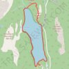
Jordan Pond Loop via South Bubble in Acadia National Park
United States > Maine > Hancock County > Mount Desert
The Jordan Pond Loop via South Bubble in Acadia National Park offers hikers a blend of serene waters and rugged terrain. Starting at the Jordan Pond House, the path meanders along the pond's edge, providing tranquil views of the surrounding mountains. Ascending the South Bubble Trail, hikers encounter steep,…
Distance: 3.7 mi • Elevation gain: 659 ft • Maximum elevation: 725 ft
Jordan Pond Loop in Acadia National Park
United States > Maine > Hancock County > Mount Desert
The Jordan Pond Loop in Acadia National Park offers a scenic and leisurely hike around the tranquil waters of Jordan Pond, surrounded by the impressive Bubbles Mountains. The trail features a mix of well-groomed gravel paths, rocky sections, and boardwalks that traverse wetlands, making it accessible for…
Distance: 3.4 mi • Elevation gain: 269 ft • Maximum elevation: 315 ft
Acadia loop hike via Pemetic Mountain, Bubble Pond, Eagle Lake, Conners Nubble and North Bubble
United States > Maine > Hancock County > Mount Desert
Distance: 5.8 mi • Elevation gain: 1,463 ft • Maximum elevation: 1,217 ft