Make a donation
Gear up for your next adventure:
As an Amazon Associate, this site earns from qualifying purchases at no extra cost to you.
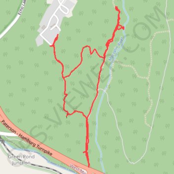
Trace near Echo Lake Road in West Milford, NJ
- Distance: 3.5 mi
- Elevation gain: 413 ft
- Maximum elevation: 1,024 ft
- Elevation loss: 420 ft
- Minimum elevation: 656 ft
- Moving time: 2 h 3 m
- Moving speed: 1.7 mph
- Maximum speed: 3.0 mph
- Total time: 2 h 38 m
- Global speed: 1.3 mph
Interactive trail map
Make a donation
Gear up for your next adventure:
As an Amazon Associate, this site earns from qualifying purchases at no extra cost to you.
Trail profile
- Distance: 3.5 mi
- Elevation gain: 413 ft
- Maximum elevation: 1,024 ft
- Elevation loss: 420 ft
- Minimum elevation: 656 ft
- Moving time: 2 h 3 m
- Moving speed: 1.7 mph
- Maximum speed: 3.0 mph
- Total time: 2 h 38 m
- Global speed: 1.3 mph
Make a donation
Gear up for your next adventure:
As an Amazon Associate, this site earns from qualifying purchases at no extra cost to you.
About this trail
Name: Trace near Echo Lake Road in West Milford, NJ trail, distance, elevation, map, profile, GPS track
Start: Woods Road, West Milford, Passaic County, New Jersey, 07435, United States (41.02687 -74.40994)
End: Woods Road, West Milford, Passaic County, New Jersey, 07435, United States (41.02671 -74.40991)
Coordinates: 41.02671 -74.41369 41.03866 -74.40645
Topography: Passaic County topographic map, elevation, terrain
Make a donation
Gear up for your next adventure:
As an Amazon Associate, this site earns from qualifying purchases at no extra cost to you.