Bluhm County Park
- Distance: 6.2 mi
- Elevation gain: 108 ft
- Maximum elevation: 814 ft
- Elevation loss: 108 ft
- Minimum elevation: 787 ft
Interactive trail map
Trail profile
- Distance: 6.2 mi
- Elevation gain: 108 ft
- Maximum elevation: 814 ft
- Elevation loss: 108 ft
- Minimum elevation: 787 ft
About this trail
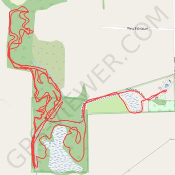
Name: Bluhm County Park trail, distance, elevation, map, profile, GPS track
Start: Bluhm Park Trail, LaPorte County, Indiana, 46391, United States (41.55180 -86.91498)
End: Bluhm Park Trail, LaPorte County, Indiana, 46391, United States (41.55183 -86.91496)
Coordinates: 41.54791 -86.92570 41.55611 -86.91491
Topography: LaPorte County topographic map, elevation, terrain