Lake Cunningham Loop Running
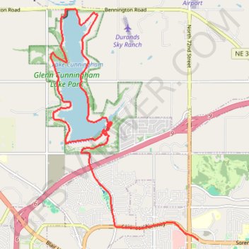
Glenn Cunningham Lake Park
- Distance: 10.1 mi
- Elevation gain: 512 ft
- Maximum elevation: 1,243 ft
- Elevation loss: 420 ft
- Minimum elevation: 1,086 ft
- Moving time: 40 m 57 s
- Moving speed: 14.7 mph
- Maximum speed: 45.0 mph
- Total time: 54 m 4 s
- Global speed: 11.2 mph
Interactive trail map
Trail profile
- Distance: 10.1 mi
- Elevation gain: 512 ft
- Maximum elevation: 1,243 ft
- Elevation loss: 420 ft
- Minimum elevation: 1,086 ft
- Moving time: 40 m 57 s
- Moving speed: 14.7 mph
- Maximum speed: 45.0 mph
- Total time: 54 m 4 s
- Global speed: 11.2 mph
About this trail
Name: Lake Cunningham Loop Running trail, distance, elevation, map, profile, GPS track
End: 7049, Sorensen Parkway, Omaha, Douglas County, Nebraska, 68122, United States (41.31822 -96.02124)
Coordinates: 41.31822 -96.06101 41.36474 -96.02124
Topography: Omaha topographic map, elevation, terrain