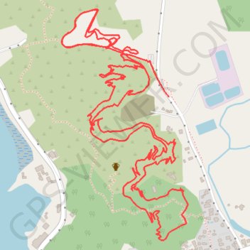
Coromandel Mountain Biking
- Distance: 3.6 mi
- Elevation gain: 548 ft
- Maximum elevation: 213 ft
- Elevation loss: 571 ft
- Minimum elevation: 26 ft
- Moving time: 39 m 40 s
- Moving speed: 5.5 mph
- Maximum speed: 24.4 mph
- Total time: 58 m 51 s
- Global speed: 3.7 mph
Interactive trail map
Trail profile
- Distance: 3.6 mi
- Elevation gain: 548 ft
- Maximum elevation: 213 ft
- Elevation loss: 571 ft
- Minimum elevation: 26 ft
- Moving time: 39 m 40 s
- Moving speed: 5.5 mph
- Maximum speed: 24.4 mph
- Total time: 58 m 51 s
- Global speed: 3.7 mph
About this trail
Name: Coromandel Mountain Biking trail, distance, elevation, map, profile, GPS track
Coordinates: -36.76066 175.48732 -36.75359 175.49214