Mount Joy Trail, Horse-Shoe Trail and Mount Misery Trail Loop in Valley Forge National Historical Park
The loop combining the Mount Joy Trail, Horse-Shoe Trail, and Mount Misery Trail presents a delightful blend of natural beauty and historical significance. Hikers can expect to traverse wooded paths that offer serene views, including glimpses of the Schuylkill River and historical landmarks such as the Knox Covered Bridge and remnants of colonial structures. The diverse terrain, featuring both gentle climbs and rocky sections, enhances the experience, making it suitable for various skill levels while allowing for encounters with local wildlife and vibrant seasonal foliage. #Hiking #Loop #River #Forest #Nature
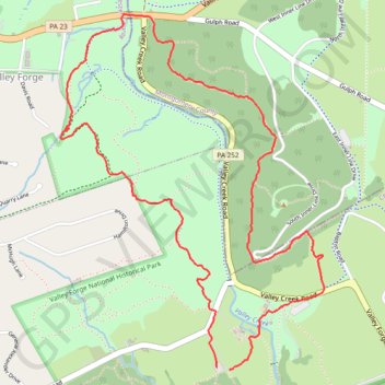
- Distance: 4.2 mi
- Elevation gain: 810 ft
- Maximum elevation: 482 ft
- Elevation loss: 801 ft
- Minimum elevation: 92 ft
- Moving time: 1 h 45 m
- Moving speed: 2.4 mph
- Maximum speed: 7.6 mph
- Total time: 1 h 53 m
- Global speed: 2.2 mph
Interactive trail map
Trail profile
- Distance: 4.2 mi
- Elevation gain: 810 ft
- Maximum elevation: 482 ft
- Elevation loss: 801 ft
- Minimum elevation: 92 ft
- Moving time: 1 h 45 m
- Moving speed: 2.4 mph
- Maximum speed: 7.6 mph
- Total time: 1 h 53 m
- Global speed: 2.2 mph
About this trail
Name: Mount Joy Trail, Horse-Shoe Trail and Mount Misery Trail Loop in Valley Forge National Historical Park trail, distance, elevation, map, profile, GPS track
Coordinates: 40.08305 -75.46686 40.09999 -75.45045
Topography: Tredyffrin Township topographic map, elevation, terrain