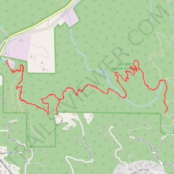
Debbie's View via Margaret's Way in Cougar/Squak Corridor
Margaret's Way Trail on Squak Mountain offers hikers a tranquil journey through lush forests and alongside babbling creeks. As you ascend, the trail provides glimpses of the surrounding landscape, with the Olympic Range gracing the horizon. Upon reaching Debbie's View, you're rewarded with a stunning panorama featuring Mount Rainier rising majestically above May Valley. #Hiking #Mountain #Forest #Nature
- Distance: 7.2 mi
- Elevation gain: 2,093 ft
- Maximum elevation: 1,824 ft
- Elevation loss: 2,093 ft
- Minimum elevation: 384 ft
- Moving time: 3 h 41 m
- Moving speed: 1.9 mph
- Maximum speed: 3.9 mph
- Total time: 5 h 53 s
- Global speed: 1.4 mph
Interactive trail map
Trail profile
- Distance: 7.2 mi
- Elevation gain: 2,093 ft
- Maximum elevation: 1,824 ft
- Elevation loss: 2,093 ft
- Minimum elevation: 384 ft
- Moving time: 3 h 41 m
- Moving speed: 1.9 mph
- Maximum speed: 3.9 mph
- Total time: 5 h 53 s
- Global speed: 1.4 mph
About this trail
Name: Debbie's View via Margaret's Way in Cougar/Squak Corridor trail, distance, elevation, map, profile, GPS track
Coordinates: 47.50192 -122.08741 47.50777 -122.06236
Topography: King County topographic map, elevation, terrain
Other hiking, mountain biking, running and outdoor activity trails
Click on a trail to view its statistics, map and profile.
Northern part of the Pacific Crest Trail (PCT)
United States > Oregon > Klamath County
Hike on the Pacific Crest National Scenic Trail from Crater Lake to Canada Border through Oregon and Washington along the Sierra Nevada and Cascade mountain ranges. #Hiking #Mountain #SierraNevada #Cascade #Nature #Forest #Park #PCT
Distance: 744.6 mi • Elevation gain: 145,367 ft • Maximum elevation: 7,569 ft