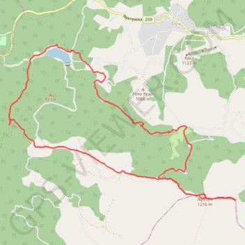
Goč Veliki Ljukten-Mali ljukten kruzna
- Distance: 8.1 mi
- Elevation gain: 1,683 ft
- Maximum elevation: 3,980 ft
- Elevation loss: 1,693 ft
- Minimum elevation: 2,913 ft
- Moving time: 4 h 26 s
- Moving speed: 2.0 mph
- Maximum speed: 3.7 mph
- Total time: 6 h 16 m
- Global speed: 1.3 mph
Interactive trail map
Trail profile
- Distance: 8.1 mi
- Elevation gain: 1,683 ft
- Maximum elevation: 3,980 ft
- Elevation loss: 1,693 ft
- Minimum elevation: 2,913 ft
- Moving time: 4 h 26 s
- Moving speed: 2.0 mph
- Maximum speed: 3.7 mph
- Total time: 6 h 16 m
- Global speed: 1.3 mph
About this trail
Name: Goč Veliki Ljukten-Mali ljukten kruzna trail, distance, elevation, map, profile, GPS track
Coordinates: 43.53570 20.80610 43.55861 20.85205
Other hiking, mountain biking, running and outdoor activity trails
Click on a trail to view its statistics, map and profile.
2022_Yu
Slovenia > Ajdovščina > Žapuže
Distance: 1,526.9 mi • Elevation gain: 105,144 ft • Maximum elevation: 6,398 ft