Make a donation
Gear up for your next adventure:
As an Amazon Associate, this site earns from qualifying purchases at no extra cost to you.
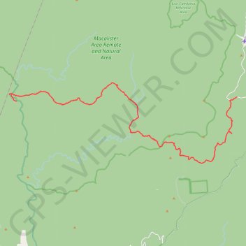
Butcher Country Track, Caledonia River Track, Dingo Hill Track, Kellys Lane
- Distance: 23.2 mi
- Elevation gain: 6,903 ft
- Maximum elevation: 4,895 ft
- Elevation loss: 3,504 ft
- Minimum elevation: 1,401 ft
- Moving time: 2 h 40 m
- Moving speed: 8.7 mph
- Maximum speed: 20.6 mph
- Total time: 3 h 32 m
- Global speed: 6.5 mph
Interactive trail map
Make a donation
Gear up for your next adventure:
As an Amazon Associate, this site earns from qualifying purchases at no extra cost to you.
Trail profile
- Distance: 23.2 mi
- Elevation gain: 6,903 ft
- Maximum elevation: 4,895 ft
- Elevation loss: 3,504 ft
- Minimum elevation: 1,401 ft
- Moving time: 2 h 40 m
- Moving speed: 8.7 mph
- Maximum speed: 20.6 mph
- Total time: 3 h 32 m
- Global speed: 6.5 mph
Make a donation
Gear up for your next adventure:
As an Amazon Associate, this site earns from qualifying purchases at no extra cost to you.
About this trail
Name: Butcher Country Track, Caledonia River Track, Dingo Hill Track, Kellys Lane trail, distance, elevation, map, profile, GPS track
Start: McAlister River Track, Reynard, Shire of Wellington, Victoria, Australia (-37.39757 146.54538)
End: Howitt Road, Arbuckle, Shire of Wellington, Victoria, Australia (-37.39456 146.75732)
Coordinates: -37.44518 146.53834 -37.38356 146.75732
Make a donation
Gear up for your next adventure:
As an Amazon Associate, this site earns from qualifying purchases at no extra cost to you.
Other hiking, mountain biking, running and outdoor activity trails
Click on a trail to view its statistics, map and profile.