
Schultz Creek Trail
- Distance: 4.8 mi
- Elevation gain: 942 ft
- Maximum elevation: 8,068 ft
- Elevation loss: 49 ft
- Minimum elevation: 7,165 ft
- Moving time: 1 h 15 m
- Moving speed: 3.8 mph
- Maximum speed: 9.1 mph
- Total time: 1 h 15 m
- Global speed: 3.8 mph
Interactive trail map
Trail profile
- Distance: 4.8 mi
- Elevation gain: 942 ft
- Maximum elevation: 8,068 ft
- Elevation loss: 49 ft
- Minimum elevation: 7,165 ft
- Moving time: 1 h 15 m
- Moving speed: 3.8 mph
- Maximum speed: 9.1 mph
- Total time: 1 h 15 m
- Global speed: 3.8 mph
About this trail
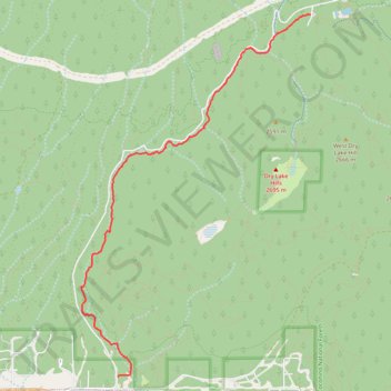
Name: Schultz Creek Trail trail, distance, elevation, map, profile, GPS track
End: Schultz Creek Trail, Coconino County, Arizona, 86004, United States (35.28469 -111.63200)
Coordinates: 35.24116 -111.66575 35.28470 -111.63200
Topography: Coconino County topographic map, elevation, terrain