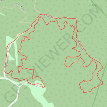
McGraw Trail - Twin Falls Resort State Park
- Distance: 4.5 mi
- Elevation gain: 459 ft
- Maximum elevation: 2,343 ft
- Elevation loss: 459 ft
- Minimum elevation: 2,215 ft
- Moving time: 13 m 52 s
- Moving speed: 19.6 mph
- Maximum speed: 26.4 mph
- Total time: 13 m 52 s
- Global speed: 19.6 mph
Interactive trail map
Trail profile
- Distance: 4.5 mi
- Elevation gain: 459 ft
- Maximum elevation: 2,343 ft
- Elevation loss: 459 ft
- Minimum elevation: 2,215 ft
- Moving time: 13 m 52 s
- Moving speed: 19.6 mph
- Maximum speed: 26.4 mph
- Total time: 13 m 52 s
- Global speed: 19.6 mph
About this trail
Name: McGraw Trail - Twin Falls Resort State Park trail, distance, elevation, map, profile, GPS track
Start: Wyoming County, West Virginia, 25876, United States (37.63042 -81.42223)
End: Wyoming County, West Virginia, 25876, United States (37.63042 -81.42219)
Coordinates: 37.62986 -81.42727 37.63802 -81.41430
Topography: Wyoming County topographic map, elevation, terrain