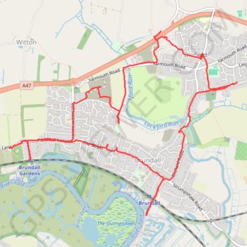
Brundall & Blofield loop walk
walking, brundall, blofield
- Distance: 6.9 mi
- Elevation gain: 295 ft
- Maximum elevation: 82 ft
- Elevation loss: 295 ft
- Minimum elevation: 3 ft
- Moving time: 2 h 44 m
- Moving speed: 2.5 mph
- Maximum speed: 5.9 mph
- Total time: 3 h 1 m
- Global speed: 2.3 mph
Interactive trail map
Trail profile
- Distance: 6.9 mi
- Elevation gain: 295 ft
- Maximum elevation: 82 ft
- Elevation loss: 295 ft
- Minimum elevation: 3 ft
- Moving time: 2 h 44 m
- Moving speed: 2.5 mph
- Maximum speed: 5.9 mph
- Total time: 3 h 1 m
- Global speed: 2.3 mph
About this trail
Name: Brundall & Blofield loop walk trail, distance, elevation, map, profile, GPS track
Coordinates: 52.61758 1.41469 52.63680 1.45379