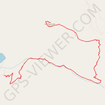
Hall Mountain Trail
- Distance: 14.5 mi
- Elevation gain: 4,127 ft
- Maximum elevation: 6,270 ft
- Elevation loss: 4,124 ft
- Minimum elevation: 2,621 ft
- Moving time: 5 h 3 m
- Moving speed: 2.9 mph
- Maximum speed: 17.7 mph
- Total time: 7 h 48 m
- Global speed: 1.9 mph
Interactive trail map
Trail profile
- Distance: 14.5 mi
- Elevation gain: 4,127 ft
- Maximum elevation: 6,270 ft
- Elevation loss: 4,124 ft
- Minimum elevation: 2,621 ft
- Moving time: 5 h 3 m
- Moving speed: 2.9 mph
- Maximum speed: 17.7 mph
- Total time: 7 h 48 m
- Global speed: 1.9 mph
About this trail
Name: Hall Mountain Trail trail, distance, elevation, map, profile, GPS track
Start: Forest Road 3300036, Pend Oreille County, Washington, United States (48.78802 -117.28143)
End: Forest Road 3300036, Pend Oreille County, Washington, United States (48.78797 -117.28133)
Coordinates: 48.78492 -117.28143 48.80706 -117.22966
Topography: Pend Oreille County topographic map, elevation, terrain