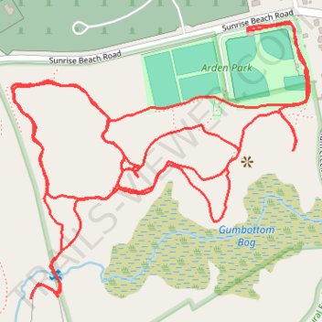
Arden Park
- Distance: 3.1 mi
- Elevation gain: 194 ft
- Maximum elevation: 85 ft
- Elevation loss: 194 ft
- Minimum elevation: 7 ft
- Moving time: 1 h 6 m
- Moving speed: 2.8 mph
- Maximum speed: 4.5 mph
- Total time: 1 h 7 m
- Global speed: 2.8 mph
Interactive trail map
Trail profile
- Distance: 3.1 mi
- Elevation gain: 194 ft
- Maximum elevation: 85 ft
- Elevation loss: 194 ft
- Minimum elevation: 7 ft
- Moving time: 1 h 6 m
- Moving speed: 2.8 mph
- Maximum speed: 4.5 mph
- Total time: 1 h 7 m
- Global speed: 2.8 mph
About this trail
Name: Arden Park trail, distance, elevation, map, profile, GPS track
Coordinates: 39.05870 -76.59601 39.06399 -76.58867
Topography: Anne Arundel County topographic map, elevation, terrain