
Walnut Woods of Evanstone trails
- Distance: 0.8 mi
- Elevation gain: 135 ft
- Maximum elevation: 719 ft
- Elevation loss: 138 ft
- Minimum elevation: 666 ft
- Moving time: 23 m 45 s
- Moving speed: 2.1 mph
- Maximum speed: 3.6 mph
- Total time: 27 m 39 s
- Global speed: 1.8 mph
Interactive trail map
Trail profile
- Distance: 0.8 mi
- Elevation gain: 135 ft
- Maximum elevation: 719 ft
- Elevation loss: 138 ft
- Minimum elevation: 666 ft
- Moving time: 23 m 45 s
- Moving speed: 2.1 mph
- Maximum speed: 3.6 mph
- Total time: 27 m 39 s
- Global speed: 1.8 mph
About this trail
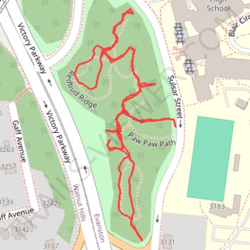
Name: Walnut Woods of Evanstone trails trail, distance, elevation, map, profile, GPS track
Coordinates: 39.13818 -84.48221 39.14099 -84.48062
Topography: Cincinnati topographic map, elevation, terrain