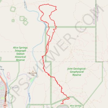
Skyline - Apwelantye Track
Alice Springs Telegraph Station Historical Reserve. #Hiking #MTB #Loop #AliceSprings
- Distance: 10.5 mi
- Elevation gain: 610 ft
- Maximum elevation: 2,096 ft
- Elevation loss: 610 ft
- Minimum elevation: 1,923 ft
Interactive trail map
Trail profile
- Distance: 10.5 mi
- Elevation gain: 610 ft
- Maximum elevation: 2,096 ft
- Elevation loss: 610 ft
- Minimum elevation: 1,923 ft
About this trail
Name: Skyline - Apwelantye Track trail, distance, elevation, map, profile, GPS track
Coordinates: -23.68415 133.89099 -23.63851 133.90625
Other hiking, mountain biking, running and outdoor activity trails
Click on a trail to view its statistics, map and profile.
Old Telegraph Station Trail
Australia > Town of Alice Springs
Alice Springs Telegraph Station Historical Reserve. #MTB #Loop #AliceSprings
Distance: 12.3 mi • Elevation gain: 505 ft • Maximum elevation: 2,110 ft