Boranup Beach - Boranup Lookout
Leeuwin-Naturaliste National Park. #Hiking #MTB #LeeuwinNaturaliste
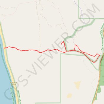
- Distance: 7.1 mi
- Elevation gain: 1,122 ft
- Maximum elevation: 715 ft
- Elevation loss: 1,122 ft
- Minimum elevation: 0 ft
Interactive trail map
Trail profile
- Distance: 7.1 mi
- Elevation gain: 1,122 ft
- Maximum elevation: 715 ft
- Elevation loss: 1,122 ft
- Minimum elevation: 0 ft
About this trail
Name: Boranup Beach - Boranup Lookout trail, distance, elevation, map, profile, GPS track
Coordinates: -34.18195 115.03266 -34.17367 115.07925
Other hiking, mountain biking, running and outdoor activity trails
Click on a trail to view its statistics, map and profile.
Part 2 38.9m
Distance: 38.9 mi • Elevation gain: 3,399 ft • Maximum elevation: 614 ft