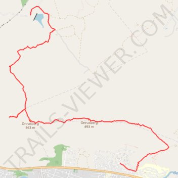
Onrusberg Ridge
- Distance: 6.7 mi
- Elevation gain: 1,736 ft
- Maximum elevation: 1,598 ft
- Elevation loss: 1,916 ft
- Minimum elevation: 157 ft
- Moving time: 2 h 40 m
- Moving speed: 2.5 mph
- Maximum speed: 7.2 mph
- Total time: 4 h 50 m
- Global speed: 1.4 mph
Interactive trail map
Trail profile
- Distance: 6.7 mi
- Elevation gain: 1,736 ft
- Maximum elevation: 1,598 ft
- Elevation loss: 1,916 ft
- Minimum elevation: 157 ft
- Moving time: 2 h 40 m
- Moving speed: 2.5 mph
- Maximum speed: 7.2 mph
- Total time: 4 h 50 m
- Global speed: 1.4 mph
About this trail
Name: Onrusberg Ridge trail, distance, elevation, map, profile, GPS track
Coordinates: -34.40804 19.15513 -34.37294 19.19638