Gore Bay Lighthouse
Manitoulin Island. Lake Huron. #Hiking #Manitoulin #Huron
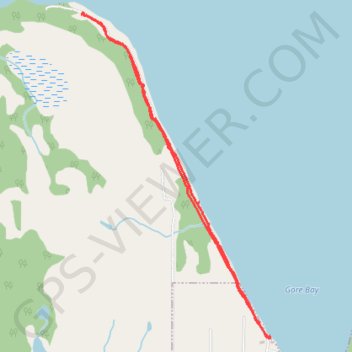
- Distance: 3.9 mi
- Elevation gain: 187 ft
- Maximum elevation: 620 ft
- Elevation loss: 187 ft
- Minimum elevation: 574 ft
Interactive trail map
Trail profile
- Distance: 3.9 mi
- Elevation gain: 187 ft
- Maximum elevation: 620 ft
- Elevation loss: 187 ft
- Minimum elevation: 574 ft
About this trail
Name: Gore Bay Lighthouse trail, distance, elevation, map, profile, GPS track
Coordinates: 45.92284 -82.48006 45.94593 -82.46085