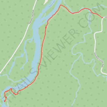
Sentier Nepisiguit vers les chutes Pabineau
- Distance: 2.1 mi
- Elevation gain: 115 ft
- Maximum elevation: 148 ft
- Elevation loss: 154 ft
- Minimum elevation: 98 ft
- Moving time: 1 h 11 m
- Moving speed: 1.8 mph
- Maximum speed: 4.9 mph
- Total time: 2 h 25 m
- Global speed: 0.9 mph
Interactive trail map
Trail profile
- Distance: 2.1 mi
- Elevation gain: 115 ft
- Maximum elevation: 148 ft
- Elevation loss: 154 ft
- Minimum elevation: 98 ft
- Moving time: 1 h 11 m
- Moving speed: 1.8 mph
- Maximum speed: 4.9 mph
- Total time: 2 h 25 m
- Global speed: 0.9 mph
About this trail
Name: Sentier Nepisiguit vers les chutes Pabineau trail, distance, elevation, map, profile, GPS track
Coordinates: 47.50710 -65.67658 47.52147 -65.65482
Other hiking, mountain biking, running and outdoor activity trails
Click on a trail to view its statistics, map and profile.
Bathurst - Black River Bridge
Canada > New Brunswick > Bathurst Parish > Bathurst
#Bike #Bathurst #BlackRiverBridge
Distance: 62.1 mi • Elevation gain: 2,152 ft • Maximum elevation: 535 ft