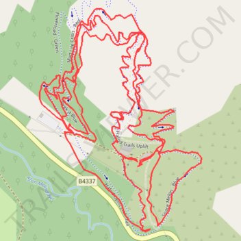
Hafod Trails
- Distance: 3.9 mi
- Elevation gain: 1,007 ft
- Maximum elevation: 912 ft
- Elevation loss: 1,007 ft
- Minimum elevation: 571 ft
- Moving time: 1 h 42 m
- Moving speed: 2.3 mph
- Maximum speed: 4.5 mph
- Total time: 1 h 53 m
- Global speed: 2.1 mph
Interactive trail map
Trail profile
- Distance: 3.9 mi
- Elevation gain: 1,007 ft
- Maximum elevation: 912 ft
- Elevation loss: 1,007 ft
- Minimum elevation: 571 ft
- Moving time: 1 h 42 m
- Moving speed: 2.3 mph
- Maximum speed: 4.5 mph
- Total time: 1 h 53 m
- Global speed: 2.1 mph
About this trail
Name: Hafod Trails trail, distance, elevation, map, profile, GPS track
Start: Hafod Wen, B4337, Llansawel, Carmarthenshire, Wales, SA19 7PH, United Kingdom (52.01896 -4.05333)
End: Hafod Wen, B4337, Llansawel, Carmarthenshire, Wales, SA19 7PH, United Kingdom (52.01895 -4.05343)
Coordinates: 52.01728 -4.05750 52.02281 -4.05092
Other hiking, mountain biking, running and outdoor activity trails
Click on a trail to view its statistics, map and profile.
Hafod MTB Trails
United Kingdom > Wales > Carmarthenshire > Llansawel
Distance: 7.2 mi • Elevation gain: 1,913 ft • Maximum elevation: 915 ft