Mount Haffner
Kootenay National Park. #Hiking #Snowshoeing #Kootenay
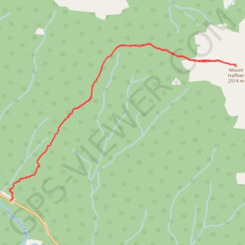
- Distance: 5.8 mi
- Elevation gain: 3,665 ft
- Maximum elevation: 8,294 ft
- Elevation loss: 3,665 ft
- Minimum elevation: 4,629 ft
Interactive trail map
Trail profile
- Distance: 5.8 mi
- Elevation gain: 3,665 ft
- Maximum elevation: 8,294 ft
- Elevation loss: 3,665 ft
- Minimum elevation: 4,629 ft
About this trail
Name: Mount Haffner trail, distance, elevation, map, profile, GPS track
Coordinates: 51.13169 -116.12898 51.15014 -116.08653