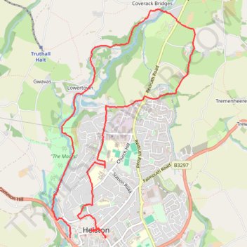
Thank you for supporting this site ❤️
Make a donation
Make a donation
Gear up for your next adventure:
As an Amazon Associate, this site earns from qualifying purchases at no extra cost to you.
Walk around Helston
- Distance: 5.8 mi
- Elevation gain: 614 ft
- Maximum elevation: 387 ft
- Elevation loss: 518 ft
- Minimum elevation: 23 ft
- Moving time: 2 h 38 m
- Moving speed: 2.2 mph
- Maximum speed: 7.1 mph
- Total time: 3 h 6 m
- Global speed: 1.9 mph
Interactive trail map
Thank you for supporting this site ❤️
Make a donation
Make a donation
Gear up for your next adventure:
As an Amazon Associate, this site earns from qualifying purchases at no extra cost to you.
Trail profile
- Distance: 5.8 mi
- Elevation gain: 614 ft
- Maximum elevation: 387 ft
- Elevation loss: 518 ft
- Minimum elevation: 23 ft
- Moving time: 2 h 38 m
- Moving speed: 2.2 mph
- Maximum speed: 7.1 mph
- Total time: 3 h 6 m
- Global speed: 1.9 mph
Thank you for supporting this site ❤️
Make a donation
Make a donation
Gear up for your next adventure:
As an Amazon Associate, this site earns from qualifying purchases at no extra cost to you.
About this trail
Name: Walk around Helston trail, distance, elevation, map, profile, GPS track
Coordinates: 50.10004 -5.28214 50.12531 -5.25752
Thank you for supporting this site ❤️
Make a donation
Make a donation
Gear up for your next adventure:
As an Amazon Associate, this site earns from qualifying purchases at no extra cost to you.