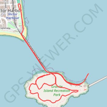
The Granite Island Run
Interactive trail map
Trail profile
- Distance: 3.6 mi
- Elevation gain: 407 ft
- Maximum elevation: 118 ft
- Elevation loss: 390 ft
- Minimum elevation: 0 ft
About this trail
Name: The Granite Island Run trail, distance, elevation, map, profile, GPS track
Coordinates: -35.56588 138.62495 -35.55379 138.63551
Other hiking, mountain biking, running and outdoor activity trails
Click on a trail to view its statistics, map and profile.