Import a GPX file

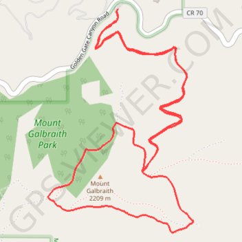
Mount Galbraith Loop

Mount Galbraith Park. #Hiking #Running #Loop #Mountain #Forest #Nature

  • Distance: 4.1 mi
  • Elevation gain: 1,119 ft
  • Maximum elevation: 7,198 ft
  • Elevation loss: 1,119 ft
  • Minimum elevation: 6,293 ft

Interactive trail map

Trail profile

  • Distance: 4.1 mi
  • Elevation gain: 1,119 ft
  • Maximum elevation: 7,198 ft
  • Elevation loss: 1,119 ft
  • Minimum elevation: 6,293 ft

About this trail

Gear up for your next adventure:

🧢Sun Protection Hats - Wide-brimmed and UPF-rated hats for high-altitude sun safety
🛰️Satellite Messengers - Emergency SOS and two-way messaging for off-grid adventures
😴Insulated Sleeping Pads - Compact and warm pads for high-elevation camping
🧦Hiking Socks - Comfortable socks to prevent blisters on long hikes
🛌Ultralight Sleeping Bags - Compact down bags for cold nights in the wilderness

As an Amazon Associate, this site earns from qualifying purchases at no extra cost to you.