Newnan, Moreland, Brooks gravel
- Distance: 112.7 mi
- Elevation gain: 5,699 ft
- Maximum elevation: 1,017 ft
- Elevation loss: 5,751 ft
- Minimum elevation: 719 ft
- Moving time: 7 h 41 m
- Moving speed: 14.6 mph
- Maximum speed: 39.2 mph
- Total time: 7 h 48 m
- Global speed: 14.4 mph
Interactive trail map
Trail profile
- Distance: 112.7 mi
- Elevation gain: 5,699 ft
- Maximum elevation: 1,017 ft
- Elevation loss: 5,751 ft
- Minimum elevation: 719 ft
- Moving time: 7 h 41 m
- Moving speed: 14.6 mph
- Maximum speed: 39.2 mph
- Total time: 7 h 48 m
- Global speed: 14.4 mph
About this trail
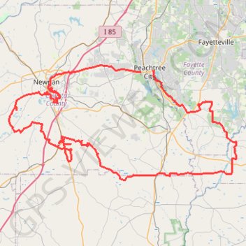
Name: Newnan, Moreland, Brooks gravel trail, distance, elevation, map, profile, GPS track
Coordinates: 33.21382 -84.87477 33.40867 -84.41272
Topography: Fayette County topographic map, elevation, terrain
Other hiking, mountain biking, running and outdoor activity trails
Click on a trail to view its statistics, map and profile.
Morrow, Forest Park, Atlanta, Fairburn
United States > Georgia > Fayette County > Peachtree City
Distance: 115.6 mi • Elevation gain: 5,984 ft • Maximum elevation: 1,066 ft