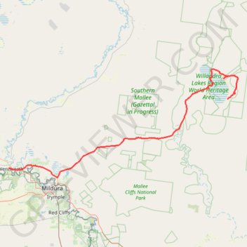
Lake Mungo National Park - Wentworth
- Distance: 111.9 mi
- Elevation gain: 1,594 ft
- Maximum elevation: 397 ft
- Elevation loss: 1,745 ft
- Minimum elevation: 115 ft
Interactive trail map
Trail profile
- Distance: 111.9 mi
- Elevation gain: 1,594 ft
- Maximum elevation: 397 ft
- Elevation loss: 1,745 ft
- Minimum elevation: 115 ft
About this trail
Name: Lake Mungo National Park - Wentworth trail, distance, elevation, map, profile, GPS track
Coordinates: -34.15023 141.91365 -33.64924 143.18254