Exit Glacier Overlook Trail and Glacier View Loop Trail in Kenai Fjords National Park
Hiking the Exit Glacier Overlook and Glacier View Loop is a breathtaking experience that immerses you in stunning glacial landscapes. Along the well-marked trails, you'll enjoy views of the shimmering blue ice of Exit Glacier, vibrant wildflowers, and the diverse local fauna, with the opportunity to spot wildlife like marmots and black bears. The trails are accessible and relatively easy, making them perfect for families, while informative signage enhances your understanding of the glacier’s retreat and the surrounding ecosystem. #Hiking #Mountain #Glacier #Forest #Nature
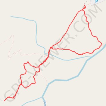
- Distance: 2.2 mi
- Elevation gain: 463 ft
- Maximum elevation: 820 ft
- Elevation loss: 463 ft
- Minimum elevation: 371 ft
- Moving time: 53 m 27 s
- Moving speed: 2.4 mph
- Maximum speed: 3.8 mph
- Total time: 1 h 56 s
- Global speed: 2.1 mph
Interactive trail map
Trail profile
- Distance: 2.2 mi
- Elevation gain: 463 ft
- Maximum elevation: 820 ft
- Elevation loss: 463 ft
- Minimum elevation: 371 ft
- Moving time: 53 m 27 s
- Moving speed: 2.4 mph
- Maximum speed: 3.8 mph
- Total time: 1 h 56 s
- Global speed: 2.1 mph
About this trail
Name: Exit Glacier Overlook Trail and Glacier View Loop Trail in Kenai Fjords National Park trail, distance, elevation, map, profile, GPS track
End: Nature Center Access Road, Kenai Peninsula, Alaska, United States (60.18852 -149.63151)
Coordinates: 60.18021 -149.64544 60.18852 -149.62842
Topography: Kenai Peninsula topographic map, elevation, terrain
Other hiking, mountain biking, running and outdoor activity trails
Click on a trail to view its statistics, map and profile.
Exit Glacier via Harding Icefield Trail in Kenai Fjords National Park
United States > Alaska > Kenai Peninsula
The Harding Icefield Trail offers an unforgettable journey through Kenai Fjords National Park, transitioning from dense forests and vibrant meadows to stark alpine landscapes. Along the way, hikers encounter spectacular views of Exit Glacier, with its crevasses and icy cascades, and wildlife such as marmots,…
Distance: 3.8 mi • Elevation gain: 3,150 ft • Maximum elevation: 3,514 ft
Harding Icefield Trail in Kenai Fjords National Park
United States > Alaska > Kenai Peninsula
The Harding Icefield Trail is an incredible yet challenging hike that rewards you with sweeping views of glaciers, ice, and rugged wilderness in Kenai Fjords National Park. Starting in a forested valley, the trail quickly ascends, offering glimpses of Exit Glacier before opening up into wildflower-filled…
Distance: 9.7 mi • Elevation gain: 3,317 ft • Maximum elevation: 3,514 ft