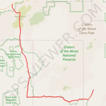
Craters of the Moon roads
Interactive trail map
Trail profile
- Distance: 55.6 mi
- Elevation gain: 1,365 ft
- Maximum elevation: 4,882 ft
- Elevation loss: 1,480 ft
- Minimum elevation: 4,268 ft
- Moving time: 2 h 47 m
- Moving speed: 19.9 mph
- Maximum speed: 42.4 mph
- Total time: 2 h 52 m
- Global speed: 19.4 mph
About this trail
Name: Craters of the Moon roads trail, distance, elevation, map, profile, GPS track
Start: US 93;US 20;US 26, Blaine County, Idaho, United States (43.35771 -113.83712)
End: Bear Trap Cave, Minidoka To Arco Road, Blaine County, Idaho, United States (42.98409 -113.35170)
Coordinates: 42.92993 -113.83760 43.35771 -113.35125
Topography: Blaine County topographic map, elevation, terrain