Make a donation
Gear up for your next adventure:
As an Amazon Associate, this site earns from qualifying purchases at no extra cost to you.
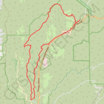
Caspers Wilderness Park Loop
Interactive trail map
Make a donation
Gear up for your next adventure:
As an Amazon Associate, this site earns from qualifying purchases at no extra cost to you.
Trail profile
- Distance: 12.9 mi
- Elevation gain: 2,297 ft
- Maximum elevation: 1,588 ft
- Elevation loss: 2,300 ft
- Minimum elevation: 404 ft
Make a donation
Gear up for your next adventure:
As an Amazon Associate, this site earns from qualifying purchases at no extra cost to you.
About this trail
Name: Caspers Wilderness Park Loop trail, distance, elevation, map, profile, GPS track
Start: Juaneño Trail, Orange County, California, 92085, United States (33.54052 -117.55221)
End: Ortega Flats Campground, Orange County, California, 92085, United States (33.54005 -117.55221)
Coordinates: 33.53867 -117.55996 33.59951 -117.51770
Topography: Orange County topographic map, elevation, terrain
Make a donation
Gear up for your next adventure:
As an Amazon Associate, this site earns from qualifying purchases at no extra cost to you.
Other hiking, mountain biking, running and outdoor activity trails
Click on a trail to view its statistics, map and profile.
San Juan Hot Springs
United States > California > Orange County
From Ortega Flats Campground in Ronald W. Caspers Wilderness Park, the hike leaves the camping area and enters the San Juan Creek corridor, following a quiet canyon setting shaped by seasonal water, riparian vegetation, oak woodland, and chaparral-covered slopes. The route continues upstream along San Juan…
Distance: 10.2 mi • Elevation gain: 1,247 ft • Maximum elevation: 814 ft