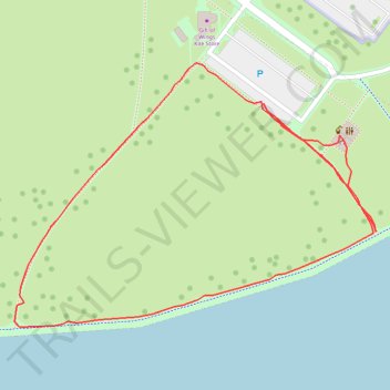
Veterans Park
- Distance: 0.6 mi
- Elevation gain: 30 ft
- Maximum elevation: 597 ft
- Elevation loss: 30 ft
- Minimum elevation: 577 ft
- Moving time: 15 m 9 s
- Moving speed: 2.5 mph
- Maximum speed: 4.0 mph
- Total time: 20 m 56 s
- Global speed: 1.8 mph
Interactive trail map
Trail profile
- Distance: 0.6 mi
- Elevation gain: 30 ft
- Maximum elevation: 597 ft
- Elevation loss: 30 ft
- Minimum elevation: 577 ft
- Moving time: 15 m 9 s
- Moving speed: 2.5 mph
- Maximum speed: 4.0 mph
- Total time: 20 m 56 s
- Global speed: 1.8 mph
About this trail
Name: Veterans Park trail, distance, elevation, map, profile, GPS track
Coordinates: 43.04257 -87.89167 43.04440 -87.88825
Topography: Milwaukee topographic map, elevation, terrain