Diamondy
- Distance: 28.5 mi
- Elevation gain: 1,329 ft
- Maximum elevation: 1,965 ft
- Elevation loss: 1,329 ft
- Minimum elevation: 1,407 ft
- Moving time: 2 h 48 m
- Moving speed: 10.2 mph
- Maximum speed: 35.3 mph
- Total time: 3 h 27 m
- Global speed: 8.3 mph
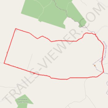
Interactive trail map
Trail profile
- Distance: 28.5 mi
- Elevation gain: 1,329 ft
- Maximum elevation: 1,965 ft
- Elevation loss: 1,329 ft
- Minimum elevation: 1,407 ft
- Moving time: 2 h 48 m
- Moving speed: 10.2 mph
- Maximum speed: 35.3 mph
- Total time: 3 h 27 m
- Global speed: 8.3 mph
About this trail
Name: Diamondy trail, distance, elevation, map, profile, GPS track
Start: Niagara Road, Diamondy, Western Downs Regional, Queensland, 4410, Australia (-26.69548 151.40888)
End: Niagara Road, Diamondy, Western Downs Regional, Queensland, 4410, Australia (-26.69547 151.40887)
Coordinates: -26.70566 151.25167 -26.63390 151.40943
Other hiking, mountain biking, running and outdoor activity trails
Click on a trail to view its statistics, map and profile.
Chahpingah to Kumbia
Ironpot Road
Distance: 29.8 mi • Elevation gain: 2,402 ft • Maximum elevation: 1,818 ft