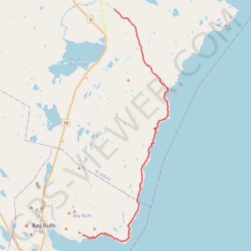
East Coast Trail - Spout Path
#Hiking #Newfoundland #Atlantic
- Distance: 13.7 mi
- Elevation gain: 2,802 ft
- Maximum elevation: 591 ft
- Elevation loss: 3,028 ft
- Minimum elevation: 7 ft
Interactive trail map
Trail profile
- Distance: 13.7 mi
- Elevation gain: 2,802 ft
- Maximum elevation: 591 ft
- Elevation loss: 3,028 ft
- Minimum elevation: 7 ft
About this trail
Name: East Coast Trail - Spout Path trail, distance, elevation, map, profile, GPS track
Start: Shoal Bay Road, St. John's, Newfoundland, Newfoundland and Labrador, Canada (47.43618 -52.75925)
Coordinates: 47.30853 -52.78494 47.43618 -52.71527
Other hiking, mountain biking, running and outdoor activity trails
Click on a trail to view its statistics, map and profile.
Whitbourne - St. John's
Canada > Newfoundland and Labrador > Whitbourne
#Bike #Whitbourne #StJohns #Newfoundland #Atlantic
Distance: 64.2 mi • Elevation gain: 4,035 ft • Maximum elevation: 768 ft