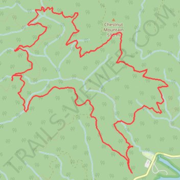
Loop hike from Ocoee Lake via Clemmer Spur, Clear Creek, Benton Falls and Clemmer
- Distance: 9.9 mi
- Elevation gain: 1,683 ft
- Maximum elevation: 1,870 ft
- Elevation loss: 1,683 ft
- Minimum elevation: 896 ft
- Moving time: 3 h 19 s
- Moving speed: 3.3 mph
- Maximum speed: 4.8 mph
- Total time: 3 h 19 s
- Global speed: 3.3 mph
Interactive trail map
Trail profile
- Distance: 9.9 mi
- Elevation gain: 1,683 ft
- Maximum elevation: 1,870 ft
- Elevation loss: 1,683 ft
- Minimum elevation: 896 ft
- Moving time: 3 h 19 s
- Moving speed: 3.3 mph
- Maximum speed: 4.8 mph
- Total time: 3 h 19 s
- Global speed: 3.3 mph
About this trail
Name: Loop hike from Ocoee Lake via Clemmer Spur, Clear Creek, Benton Falls and Clemmer trail, distance, elevation, map, profile, GPS track
Start: Scenic Spur, Polk County, East Tennessee, Tennessee, United States (35.11499 -84.57902)
End: Scenic Spur, Polk County, East Tennessee, Tennessee, United States (35.11510 -84.57907)
Coordinates: 35.11499 -84.60253 35.14156 -84.57201
Topography: Polk County topographic map, elevation, terrain
Other hiking, mountain biking, running and outdoor activity trails
Click on a trail to view its statistics, map and profile.
Slick Rock Loop Trail, Dana FS Road, Scenic Overlook and Naked Widow Loop Trail
United States > Tennessee > Polk County
Chilhowee Mountain
Distance: 9.8 mi • Elevation gain: 1,516 ft • Maximum elevation: 2,303 ft
Clear Creek and Azalea Trails Loop via Chestnut Mountain and Chilhowee Campground in Cherokee National Forest
United States > Tennessee > Polk County
Distance: 15.0 mi • Elevation gain: 2,008 ft • Maximum elevation: 1,975 ft
Clear Creek Trail and Mulepen Branch Trail
United States > Tennessee > Polk County
Distance: 13.0 mi • Elevation gain: 1,670 ft • Maximum elevation: 1,978 ft